 |
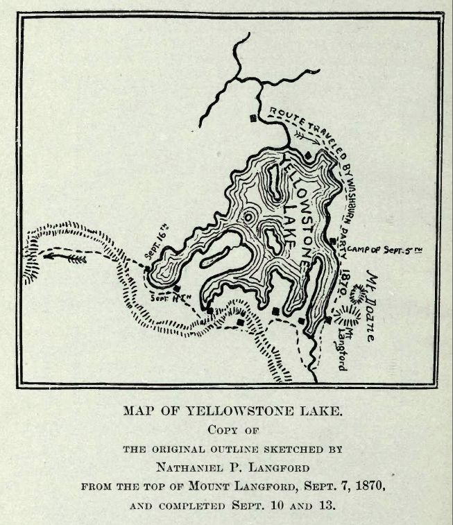
| Yellowstone Lake Map, 1870 |
The forests, peaks, and valleys surrounding
Yellowstone Lake have been inhabited by humans for more than 11,000 years.
John Colter, a member of the
Lewis and Clark Expedition, is believed the first non-native to see Yellowstone Lake circa 1807-08.
Fur trading brought trappers to the lake. Mountain man
Osborne Russell wrote:
"The lake is about 100 miles in circumference, bordered on the east by high ranges of mountains whose spurs terminate at the shore and on the west by a low bed of piney mountains. Its greatest width is about fifteen miles, lying in an oblong form south to north, or rather in the shape of a crescent. Near where we encamped were several hot springs which boiled perpetually."
— journal entry, 1836
The U.S. Congress appropriated $40,000 in 1871 to underwrite a survey led by geologist
Ferdinand Hayden to explore and document the northwestern region of the
Territory of Wyoming.
A year later in 1872, Congress passed legislation that was signed into law by President
Ulysses Grant to create Yellowstone National Park.
From Hayden's correspondence to
Spencer Baird, of the
Smithsonian Institution, regarding the survey of Yellowstone Lake:
Dear Professor Baird,
Your letters of June 6th and July 3rd were brought us from Fort Ellis by Lt. Doane who has just arrived to take command of our escort and accompany my party the remainder of the season.
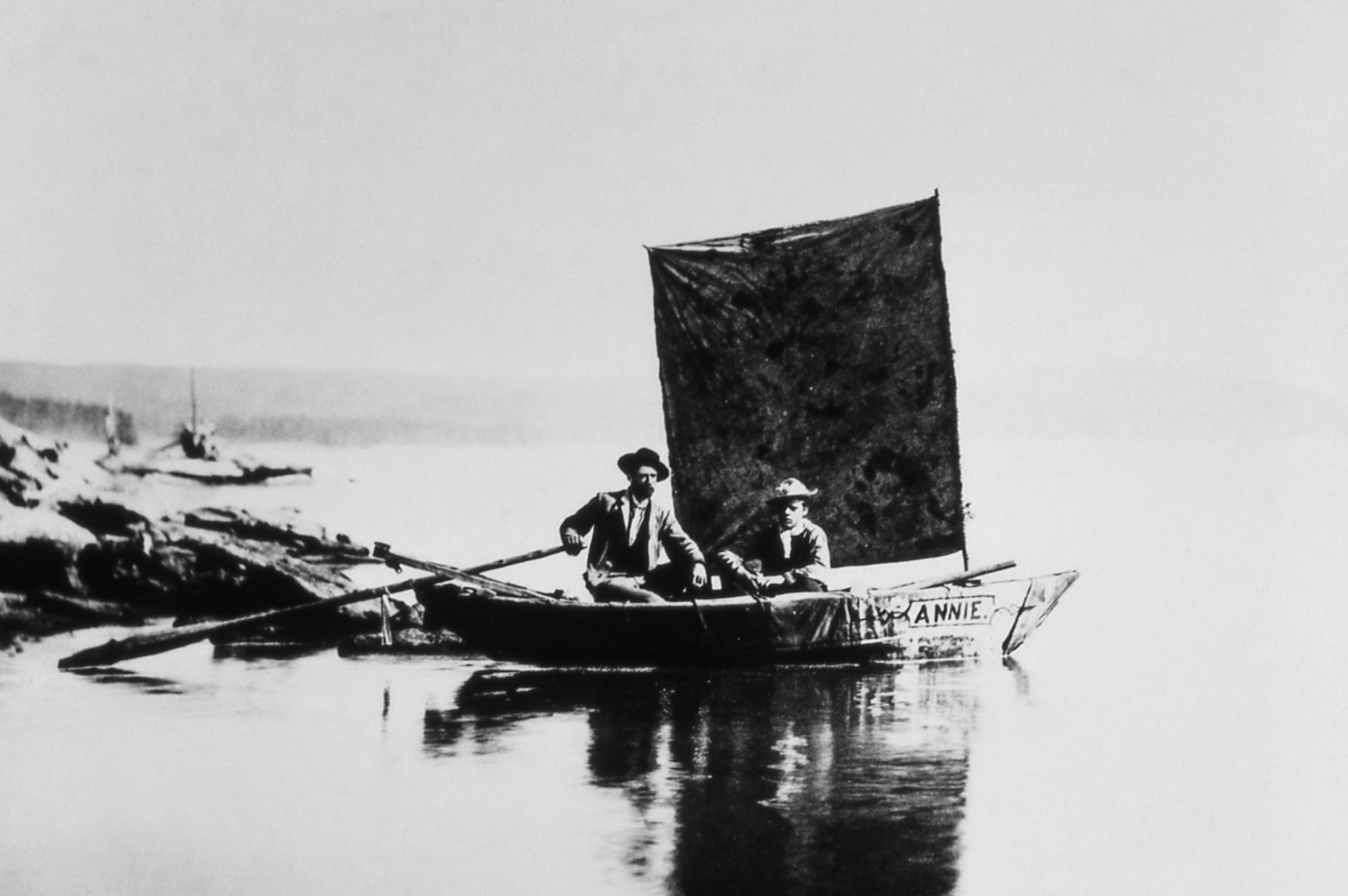
We arrived at the banks of the Yellow Stone Lake July 26th and pitched our camp near the point where the river leaves the Lake. Hence we brought the first pair of wheels that ever came to the Lake with our Odometer. We launched the first Boat on the Lake, 4.5 feet wide and 11 feet long, with sails and oars.
A chart of this soundings will be made. Points have been located with a prismatic compass all around the Lake. A man stands on the shore with a compass and takes a bearing to the man in the Boat as he drops the lead, giving a signal at the time. Then a man in the Boat takes a bearing to the fixed point on the shore where the first man is located and thus the soundings will be located on the chart. Henry Elliot and Mr. Carrington have just left in our little boat, the Annie. [They] will make a systematic sketch of the shore with all its indentations, with the banks down, indeed, making a complete topographical as well as pictorial sketch of the shores as seen from the water, for a circuit--of at least 130 miles.
One of the islands has been explored. We have called it Stevenson's Island as he was undoubtedly the first human that ever set foot upon it.
We found everything in the Geyser region even more wonderful than it has been represented.
I send this back to you by James [Stevenson] who returns to our permanent camp for supplies.
We hope to reach Fort Ellis about the 1st or 5th of September. Schönborn does splendid Topographical work. Write at once.
Yours Truly,
F. V. Hayden
I will send you some Photographs soon.
Accompanying Hayden on the expedition was American painter, Civil War veteran, and geological survey photographer
William H. Jackson, and mineralogist
Albert C. Peale.
 |
The "Annie", an early and perhaps first boat on Yellowstone Lake
Photograph by William H Jackson, 1871 |
At nearly a mile and a half above sea level Yellowstone Lake is the largest freshwater lake above 7,000 ft in North America.
As I write now, the moon is shining brightly and is reflected from the surface of the water, which is now considerably quieter, the wind having gone down. The lake is 7,000 feet above the sea.
— Albert C. Peale, journal entry 28 July 1871
 |
Ice Out, Yellowstone Lake
Bob MacNeal, May 2012 |
Ice, nearly 3 ft thick in some areas, covers most of Yellowstone Lake between December and May, except in shallow water near hot springs. Freeze over typically occurs in early December. Ice out typically occurs in late May or early June.
"One's destination is never a place, but a new way of seeing things."
― Henry Miller
REFERENCES


_(14786967813).jpg)

